

From my experience with Ultimaps, I found it excels at simplifying complex geographic data into clear, interactive maps powered by AI. The platform’s intuitive interface makes it accessible even for users without deep GIS expertise, which is a significant advantage. It’s particularly well-suited for professionals in real estate, marketing, and urban planning who need to visualize location-based insights quickly. However, the limited free trial and lack of a mobile app might be a drawback for some users. Overall, if your work relies on spatial data analysis and you want an AI-enhanced mapping tool, Ultimaps delivers practical and effective solutions.
Ultimaps AI Mapping Tool for Location Intelligence and Data Visualization
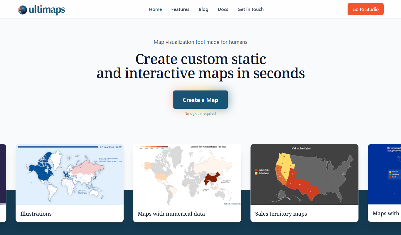
Ultimaps is an AI-driven platform that helps users create interactive maps and analyze geographic data for better location intelligence and decision-making.
- Best for
- Real Estate Analysis
- Key capability
- AI-Powered Map Generation

Do you recommend this tool?
What is Ultimaps?
Ultimaps is an AI-driven mapping and location intelligence platform that enables users to create insightful, interactive maps for data visualization and spatial analysis. It helps businesses and professionals visualize complex geographic data to make informed decisions.
Key features of Ultimaps
Ultimaps offers AI-powered map creation, customizable data layers, interactive visualizations, and integration capabilities to enhance location-based insights across industries.
AI-Powered Map Generation
Automatically create maps that highlight key spatial patterns and trends.
Customizable Data Layers
Add multiple data layers to maps for detailed analysis and visualization.
Interactive Visualizations
Engage with maps through zoom, filters, and dynamic data exploration.
Data Integration
Connect with various data sources to enrich map content and insights.
Export and Sharing Options
Easily export maps or share interactive versions with team members or clients.
Pros and cons of Ultimaps
Pros
- User-friendly AI-powered map creation
- Customizable and interactive visualizations
- Supports multiple data formats and integrations
- Useful for diverse industries and applications
- Responsive customer support for paid plans
Cons
- Limited free trial period
- No mobile app available
- Pricing may be high for small businesses
Key use cases for Ultimaps
Real Estate Analysis
Use Ultimaps to visualize property data and analyze location-based trends for better investment decisions.
Market Research
Leverage AI-powered maps to identify customer demographics and optimize marketing strategies.
Urban Planning
Plan infrastructure projects by visualizing geographic data and assessing spatial relationships.
Sales Territory Management
Define and optimize sales territories based on geographic and demographic insights.
Logistics and Supply Chain
Improve route planning and distribution by analyzing location data effectively.
How Ultimaps works
- 1
Sign Up
Create an account on the Ultimaps website to access the platform.
- 2
Upload or Connect Data
Import your geographic or tabular data or connect to external data sources.
- 3
Customize Maps
Use AI tools to generate maps, add layers, and customize visualizations.
- 4
Analyze and Share
Explore insights through interactive maps and share results with stakeholders.
Who is using Ultimaps
Real estate professionals
Marketing analysts
Urban planners
Sales managers
Logistics coordinators
Ultimaps pricing
Free Trial
$0 for 14 days
Access core features with limited usage to evaluate the platform.
Professional
$49/month
Full access to all features with higher data limits and priority support.
Enterprise
Custom pricing
Tailored solutions with advanced integrations and dedicated account management.
Plans and prices are as published by the vendor and can change. Check the official site before you buy. Open the pricing page (opens in a new tab)
Frequently asked questions about Ultimaps
You can upload geographic data such as shapefiles, CSVs with location coordinates, or connect to external data sources.
Ultimaps offers a free trial for 14 days to explore the platform’s features.
Yes, you can export maps or share interactive versions with others.
Ultimaps supports data integration from various sources to enhance mapping capabilities.
It depends on your specific needs and how you plan to use the tool. The official website and documentation are the best sources for the latest details.
It depends on your specific needs and how you plan to use the tool. The official website and documentation are the best sources for the latest details.
Data handling and security practices vary by provider. Review the official privacy policy to understand how your data is stored and used.
Sign in to review this tool.
Sign In to ReviewNo reviews yet
Be the first to share how this tool worked for you.
Ask about pricing, limits, or how it compares — or answer someone else.
Sign In to AskNo questions yet
Have a question about using or paying for this tool? Be the first to ask.
Featured on TiorAI



Alternative Tools
Explore similar AI tools that might fit your needs

Enterprise
Mapbox
Mapbox is a developer platform providing customizable maps, navigation, and geospatial data APIs for building location-based applications.
More AI Ai Tools tools
Other tools in the same category, for when this one is not quite the fit.

Free
Pogo Travel
Pogo Travel is an AI-driven platform that generates personalized travel itineraries based on your preferences, travel dates, and interests, offering collaborative planning and offline access.

Freemium
PlaninGo
PlaninGo is an AI travel planning tool that generates personalized trip itineraries and guides based on your preferences, helping you plan efficient and enjoyable trips.

Free
Travelwiz
Travelwiz is an AI-powered travel planning tool that creates personalized trip itineraries and offers tailored travel recommendations based on user preferences.

Free
Momo
Momo is an AI-powered assistant that automates workflows, manages tasks, and enhances team collaboration by integrating with popular productivity tools.

Free
Nextrip
Nextrip AI is an online travel planning tool that uses artificial intelligence to generate personalized trip itineraries based on your preferences, travel dates, and destinations.

Freemium
TravelBot AI Travel Assistant
TravelBot AI Travel Assistant is a web-based platform that uses artificial intelligence to help users create personalized travel itineraries, book flights and hotels, and receive tailored travel recommendations based on preferences and budget.
Freemium
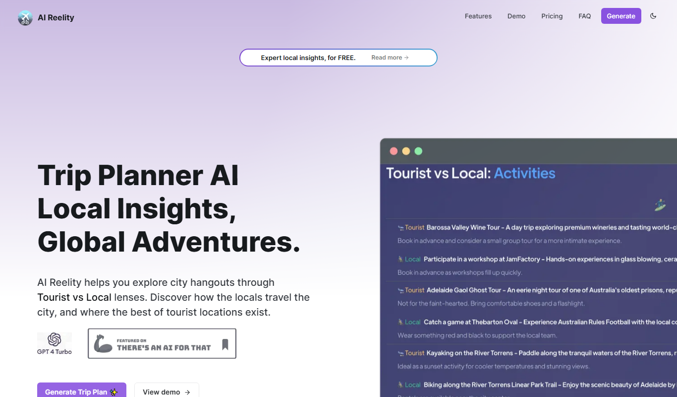
AIreelity
AIreelity is an AI-driven video creation platform that transforms text scripts into engaging marketing videos with customizable templates and AI voiceovers.

Free
AIJOURNEY
AIJOURNEY is an AI-driven career development tool that provides personalized career path recommendations, identifies skill gaps, and offers curated learning resources to help users advance professionally.